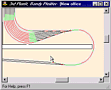
 | Draw track easily and intuitively using conventional Press-and-Move
drawing or the AutoCAD Click-Move-Click style. Auto snap to endpoints during draw
and move operations. Track objects are automatically aligned when moved to
one another. |
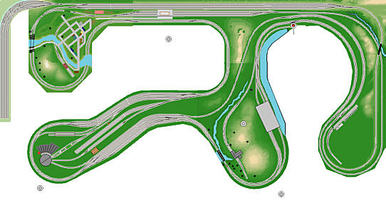
|  Simple and effective pan-and-zoom allows navigation of the largest
layouts. Use multiple open documents to quickly cut, paste and copy from drawing to
drawing. Click for animation (524K) Simple and effective pan-and-zoom allows navigation of the largest
layouts. Use multiple open documents to quickly cut, paste and copy from drawing to
drawing. Click for animation (524K) |
| Automatic Rails and Ties. Track is drawn as lines at low magnification.
As you zoom in, rails and ties appear in their correct proportions for your choice of
prototype gauge. |
| Automatic alignment™ ensures all track is properly aligned. Simply
move objects in Track Layers to one another - the target object highlights and the moving
object is aligned when the mouse button is released. Objects automatically snap to
endpoints in Track Layers. |
| Automatic connections™ trim circles, lines and spirals in one easy
step. Create easements in the same connection step, if you prefer. Two mouse clicks
connect any two track objects, automatically trimming them and adding easements if you
choose. |
| Tilt-up construction™... design buildings wall by wall in two
dimensions, align the corners, and tilt each wall into place with a single command. |
| Smart Turnouts™ accept precise specifications of popular turnouts
or hand-laid turnouts and accurately represent the turnout in the drawing. Instantly
create crossovers, yards, and a variety of custom trackwork. |
| 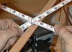 Reference Points™ allow you to register the position of several
tape measures in the layout area and directly read the distances to important locations,
in three dimensions, for all Reference Points. Reference Points™ allow you to register the position of several
tape measures in the layout area and directly read the distances to important locations,
in three dimensions, for all Reference Points. |
| Nested groups with in-place editing. Double-click a group to edit its
contents; double-click embedded groups to successively edit all embedded groups, adding or
removing objects freely. |
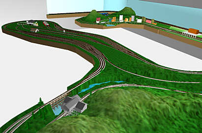
| View and rotate your drawing in 3D in real time. Nearer
objects draw over farther objects for visual realism. OpenGL provides professional-quality
results in 3D. |
| Elevation Markers™ can be placed at any location on
track objects. They
are instantly updated to the current elevation of the chosen point, optionally including the
distance from the floor to "zero railhead". |
| Many color options: color by layer, color by object type, monochrome
and native object colors. Assign each line a different color if you wish for realistic
locomotives, cars, trees, landscape, and buildings. |
|  Work in any measurement system (American or metric). Display American
units in decimal feet, feet and decimal inches, fractional inches, or feet, inches and
fractions. Switch between metric and American units freely! Enter any value in
either system at any time, regardless of current display preference. Designed to meet the
needs of the most demanding European and Z-Scale designers. Work in any measurement system (American or metric). Display American
units in decimal feet, feet and decimal inches, fractional inches, or feet, inches and
fractions. Switch between metric and American units freely! Enter any value in
either system at any time, regardless of current display preference. Designed to meet the
needs of the most demanding European and Z-Scale designers. |
| Switch between Model Scale and actual scale at any time. Lay track
using traditional measurements such as 30" radii, while drawing buildings and trees
in feet and inches using their true measurements. Have prototype track plans? Enter
lengths and radii in 1000's of feet and let 3rd PlanIt do your conversions! |
| Design true 12" railroads in prototype units. Using Model Scale as
Map Scale allows you to select a preferred map scale for accurate documentation of
prototype railways in their native surroundings. |


 Print to any scale, including 1:1, on any Windows-supported printer.
Print multiple aligned pages for large scales, or print complete layout on a single page.
Plotters are supported as well.
Print to any scale, including 1:1, on any Windows-supported printer.
Print multiple aligned pages for large scales, or print complete layout on a single page.
Plotters are supported as well.